3Di has the most extensive API for hydrodynamic modelling in the world With the API it is possible to create fully automated workflows from model building to analyzing. Any click done by a user in one of our interfaces is available through API endpoints.
We have split our API in several parts:
- The Models & Simulations API
- The Results API (open source)
- The Lizard API (for radar & scenario datawarehouse)
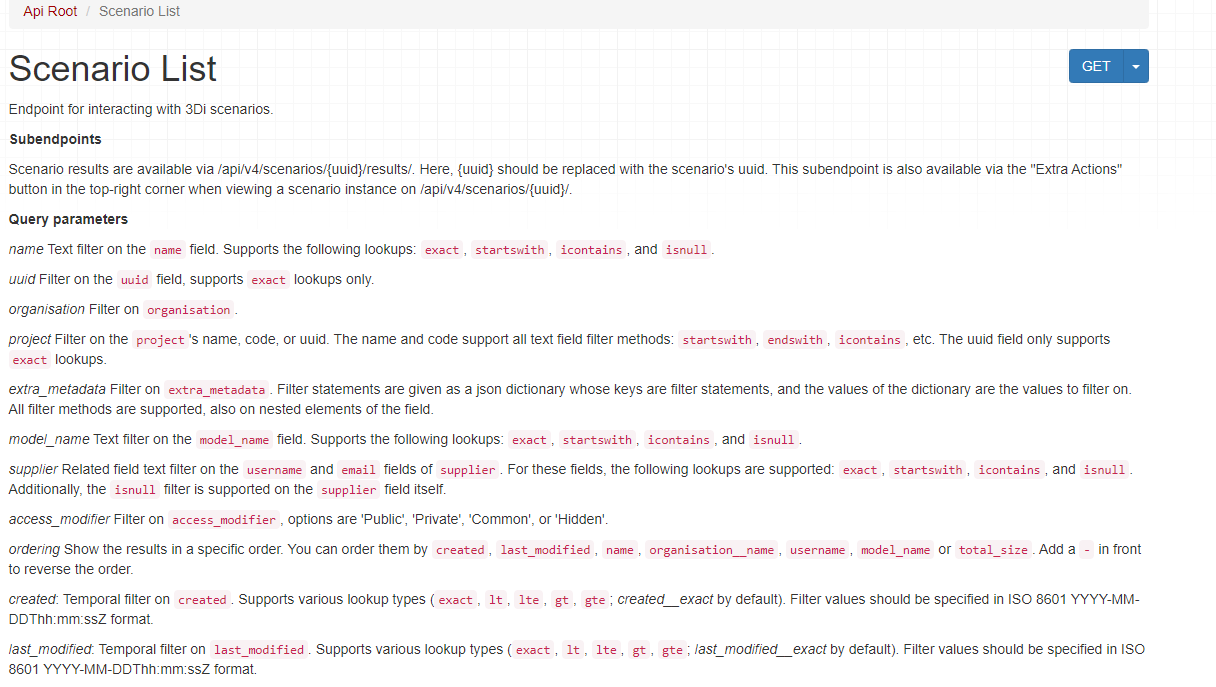
The Models & Simulations API
The Models and Simulations API enables full control on setting up a simulation, running, following, interactions and downloading the results.
The API has an openapi implementation. Example code snippets are available in the documentation.
The Swagger representation with all available endpoints is available on request.
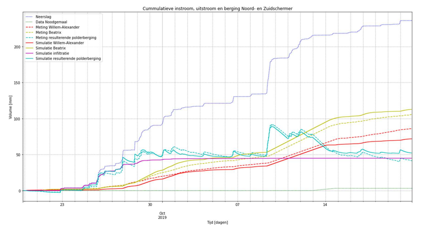
Water balance based on measurements (dashed lines) and simulation results (continuous lines). The forcing is the rainfall (blue). The outflows of the polder are the pumping stations Willem-Alexander (red), Beatrix (yellow) and an emergency pumping station (green). The resulting water balance is the increased storage in the polder (turquoise). In purple the simulated infiltration is shown. Because the current model schematization does not include the restoring capacity of the soil, the soil becomes saturated.
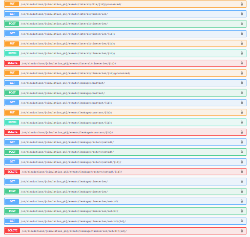
The Results API
The results API is a python package binding the schematisation in spatialite format with the NetCDF result file. The endpoints help in selecting the appropriate parts of the model and help to
- batch process multiple results
- do a customized analysis of a situation
- have standardized checks on model results
The Lizard API
The Lizard API is our API for long term storage of modelling result, postprocessing results and dissemination. It comes with tons of filtering options.
The Lizard API enables you to:
- download (postprocessed) selected results directly in GTiff format
- view the results in WMS format in a GIS viewer of choice
Use cases
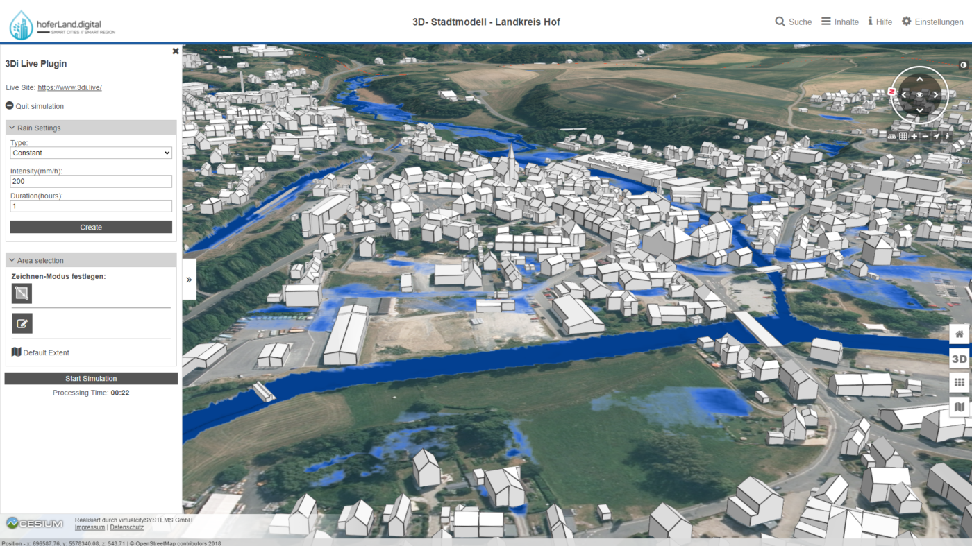
Virtual City Systems
Virtual City Systems has created an integration with the 3Di hydrodynamic simulation software using the API. Doing so this combined the power of a 3D environment with an interactive flood simulation
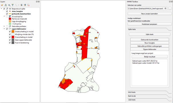
Water Authority of North Holland
The Water Authority of North Holland has built a custom 3Di plugin to support their workflows.
The plugin is completely open source and is available here:
Scripting tools
With API it is possible to create your own scripting tools. There are many examples available on github.
Here you find notebooks with which you can do the following:
- notebook 1: From starting your simulation to analysing your results
- notebook 2: Using 3Di and Lizard together in one notebook for validation purposes
- notebook 3: Download a maximum waterdepth raster from Lizard from a 3Di simulation
- notebook 4: Download a series of water depth maps from Lizard from a 3Di simulation
- notebook 5: Start a 3Di simulation and use a table structure control