3Di urban water – The Hague
The Hague, the city known for many stately places like the palaces of the Royal family and the home of the Dutch Government. On a daily basis the municipality is working on urban water management and climate adaptation to make sure that the city is adapted to climate change and urban flooding is prevented.
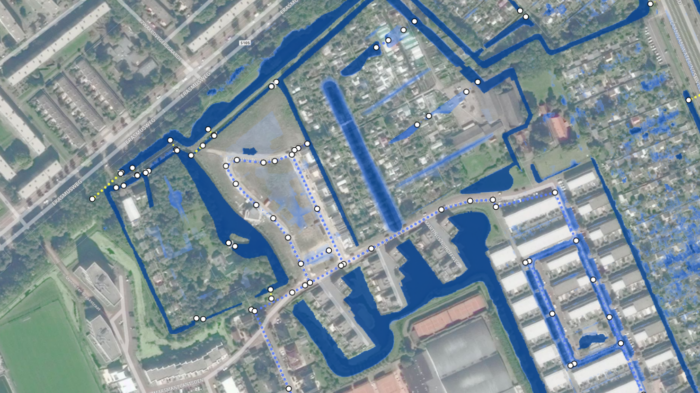
Visual presentation of 3Di results for the integral model where 1D components are represented by dashed lines and white dots, and the maximum water depth is shown in blue. The darker blue represents increased water depths.
In 2015, as one of the first municipalities (together with Amsterdam and Rotterdam), the Hague used 3Di to create highly detailed integrated hydrodynamic models of the urban area. For the first time, the sewage system was integrated and coupled to the elevation map of the Hague which had never been done before. This innovation made it possible to track where water came out of the sewage system and which streets flooded, and also provided insight into the hydraulic and environmental functioning of the sewage. It is used to evaluate the measures implemented in recent years. With 3Di the municipality could calculate much more accurately how the water from the sewerage system flows over ground level and where — and how much — nuisance it causes during extreme rainfall events. The outcome has been translated into new measures to meet current and future guidelines.
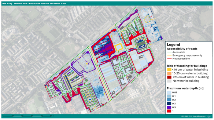
Translation of 3Di results of the integral model to levels of acceptance for flooding for roads, buildings and water depth.
With the 3Di models at its disposal, the municipality performed follow-up studies to design climate-proof urban areas. In 2019, the Erasmus veld district was under development and had to become the most sustainable district in The Hague. A climate-proof design of public space was part of this ambition. The hydrodynamic models have been amended in such a way that the urban planning design was integrated in 3Di and made it possible to subject the design to a climate stress test for extreme rainfall events. The lessons learned were implemented in a generic approach for climate adaptive urban planning design for the city of the Hague. Another good example was the redevelopment of the Spuikwartier area. 3Di made it possible to test the urban design and make choices about an appropriate layout of a square within this environment. With an integrated hydrodynamic model like 3Di the municipality could choose the right design variant for rainwater drainage to prevent urban flooding.
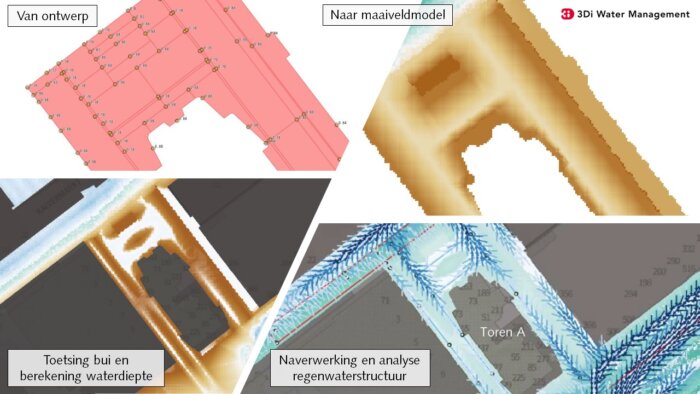
Process to go from landscape design (top left), implemented in a digital elevation model (top right), resulting in a new elevation model (bottom left), which is implemented in 3Di to obtain discharges (bottom right).