Mastering the Flow – Introduction to urban water management
Welcome to the world of modelling urban drainage infrastructure design and the inclusion into spatial planning. In a series of blogposts called: Mastering the flow, we will dive deep into urban water management practices to show 3Di can help you master the flow of water in the urban built environment.
This blog will explore the key considerations and principles that underpin successful modelling of urban drainage infrastructure design and the incorporation of spatial planning. From understanding rainfall-runoff relations, to integrating green spaces, to slow down the flow towards underground drainage infrastructure. We will uncover best practices to creating resilient and sustainable cities.
Understanding the challenges urban drainage systems face
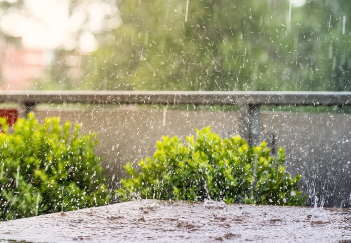
Urban drainage systems face several challenges due to the complex nature of urban environments. One of the primary challenges is the rapid urbanization and expansion of cities. As cities grow, the natural landscape is replaced by impervious surfaces such as concrete and asphalt, which prevent the natural infiltration of rainwater.
This change in surfaces leads to a change in the rainfall-runoff relation, which can overwhelm traditional drainage systems and cause flooding. Additionally, the loss of natural drainage features, such as wetlands and natural waterways, reduces the capacity of cities to manage stormwater.
Another important challenge in urban water management is the change in rainfall intensities due to climate change. Most cities’ infrastructure and spatial plans have been developed decades ago. As a result, the drainage infrastructure is designed on outdated rainfall trends. Subsequently, streets are more often flooded because the drainage infrastructure’s capacity is exceeded more frequently.
Lastly, in many cities the underground space has become utilized extensively. This results in constraints on traditional urban drainage infrastructure designs. To deal with extreme rainfall, pipes with increased diameters could be an option. Besides the (possible) extravagant investment cost associated with this option, in many places there simply is no space available to expand the piped network.
All these challenges require better insight in the functioning of the existing physical environment and water systems, what-if analyses to quantify the consequences of changing weather patterns and assess the impact of potential investments and interventions.
Key Components of Urban Drainage Infrastructure
Traditional urban drainage infrastructure consists of various components that work together to manage stormwater and prevent flooding. These components include pipes, channels, storage facilities, treatment systems, and control structures. Let’s explore each of these key components in detail.
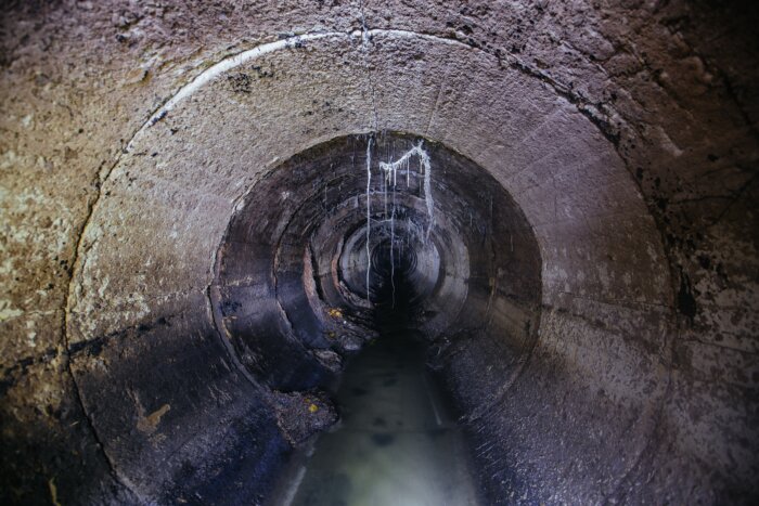
Pipes

Underground pipes are the backbone of urban drainage systems. They collect stormwater from various sources and transport it to storage facilities or treatment systems. Pipes come in different sizes and materials, depending on the volume of water they need to handle.
Channels

Open channels, such as canals and ditches, are used to convey stormwater across different parts of the city. They are especially useful in areas with high water flow, as they can handle larger volumes of water compared to pipes.
Storage Facilities

Storage facilities, such as detention ponds and tanks, are designed to temporarily store excess stormwater during heavy rainfall events. They help to reduce the peak flow of stormwater, preventing flooding downstream.
Treatment systems

Treatment systems are essential for managing the quality of stormwater before it is discharged into water bodies. These systems remove pollutants and contaminants from stormwater, ensuring that it does not harm the environment
Control Structures

Control structures make it possible to convey water to the intended location. Pumps are able to move water upwards, weirs and other structures can ensure water levels in a certain area remain high before flowing down.
Modelling approaches to Urban Drainage Infrastructure Design
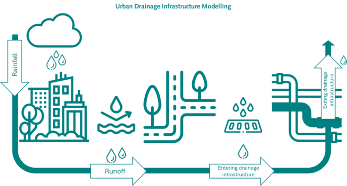
To design urban drainage infrastructure that can deal with excessive stormwater several steps need to be taken to determine the dimensions and operations of the systems’ components. The first step is to translate rainfall information to runoff. The second step is to determine how the water enters the drainage infrastructure. Lastly, the drainage design needs to be assessed based on whether water resurfaces and if so, where this happens. Thanks to the fully integrated computational core of 3Di, this is calculated with almost no mass balance error and very stable exchange between the different domains.
The translation from rainfall to runoff
Rainfall-runoff relations are typically modelled in hydrology using various approaches that convert precipitation into runoff. These models fall into three primary categories: empirical, conceptual, and physics based.
- Empirical Models: These rely on statistical relationships derived from historical rainfall and runoff data. They are simple and require minimal data but lack the ability to predict changes outside the range of observed conditions. Examples include the Curve Number method developed by the USDA Soil Conservation Service.
- Conceptual Models: These simulate the hydrological cycle’s major components using a series of interconnected reservoirs representing different processes like interception, infiltration, and baseflow. They balance simplicity and physical realism, often requiring calibration.
- Physics Based Models: These use mathematical representations of the physical processes governing runoff generation, such as the Horton equation for infiltration movement and the Saint-Venant equations for overland flow. They offer high accuracy and predictive power but require extensive data and computational resources.
Rainfall-runoff: Hydrological vs. Hydrodynamic Modelling
The primary difference between hydrological and hydrodynamic modelling in rainfall-runoff relations lies in their spatial scale, complexity, and focus. Hydrological models are broader and less detailed, concentrating on the generation and quantity of runoff over larger areas. They provide inputs for hydrodynamic models, which then take over to simulate the detailed behaviour of runoff in specific locations, accounting for the intricacies of water flow and interactions with the environment.
In essence, hydrological models answer, “how much water will be generated from rainfall in a catchment?” while hydrodynamic models address “how will this water move over land, through rivers and in urban systems?” Both types of models are integral to comprehensive water resource management, providing complementary insights into different aspects of the hydrological cycle.
The distinction between hydrological and hydrodynamic modelling lies in their focus and the processes they simulate concerning the rainfall-runoff relationship.
Hydrological Modelling:
Hydrological models primarily deal with the water cycle components on a catchment scale, focusing on how precipitation translates into runoff. These models consider precipitation, evaporation, transpiration, infiltration, and storage in soil and groundwater. The core objective is to understand and predict the quantity and timing of runoff entering a river system. They typically simplify the flow processes, often using lumped or semi-distributed approaches, where the watershed is divided into sub-basins, but the flow within each sub-basin is treated homogeneously.
Key aspects include:
- Simplified representation of flow paths.
- Use of empirical or semi-empirical equations.
- Calibration using historical data to match observed runoff patterns.
Hydrodynamic Modelling:
Hydrodynamic models focus on the detailed movement and behaviour of water within river channels, floodplains, and urban drainage systems once runoff has entered these systems. They simulate the dynamics of water flow using the principles of fluid mechanics, often employing the Navier-Stokes or Saint-Venant equations to capture the depth, velocity, and direction of water flow in two or three dimensions. These models are crucial for detailed flood forecasting, river management, and infrastructure design.
Key distinctions include:
- Detailed spatial and temporal resolution of water movement.
- Use of full or simplified dynamic flow equations.
- Integration with topographic and bathymetric data to model complex flow patterns and interactions.
Water entering the urban drainage infrastructure
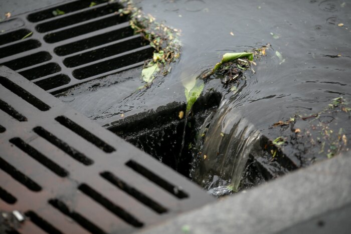
Modelling how water enters urban drainage infrastructure can be done by applying several methodologies:
- Direct Inflow: Water is added directly into the drainage network at specific nodes, representing direct connections such as roof drains or street inlets. This approach models the system without spatial dimensions and is therefore also known as 0D flow. It focuses on the water volume balance at points. It’s useful for simple systems where detailed spatial resolution isn’t required. For urban drainage, it typically involves lumped parameters for quick estimations of system response. Water inflow is directly added to nodes in the model.
- Subcatchment Approach: Urban areas are divided into subcatchments, each contributing runoff to a particular point in the drainage system. This method uses rainfall-runoff models to calculate the amount of runoff from impervious and pervious surfaces within each subcatchment. The water enters the drainage system at the given point and from there on flow is calculated in a single dimension, such as pipes or channels. That is why this is also known as 1D modelling. This method simulates how water enters and moves through the drainage network, allowing for detailed analysis of flow rates, velocities, and hydraulic grade lines. It’s widely used for sewer and stormwater pipe network analysis. The water enters following the subcatchment approach.
- Rain on grid: This approach captures rainfall directly on the grid together with complex interactions between surface water and the drainage network. This is done by adding a second dimension, modelling flow across surfaces. It’s essential for accurately representing flooding scenarios in urban areas where surface flow patterns influence how water enters the drainage system.
Each method serves different needs, with rain on grid modelling offering the highest resolution and realism for urban flood management.
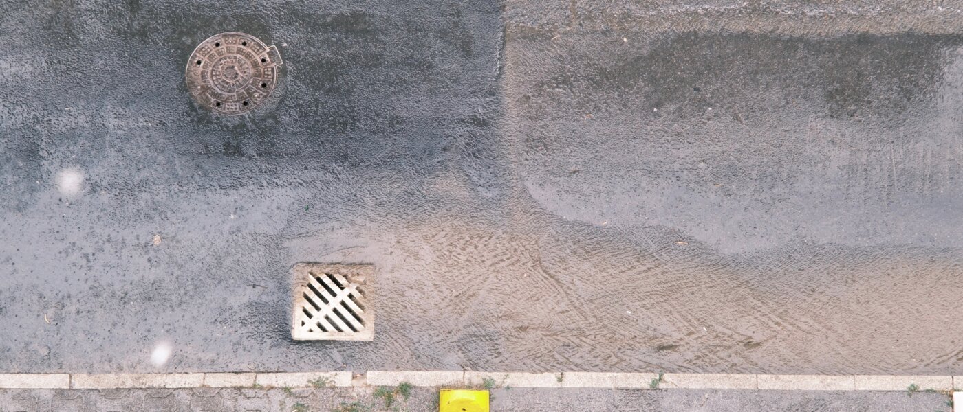
Interaction between drainage infrastructure and public space
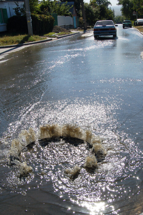
Urban drainage infrastructure is designed to deal with rainfall events. As discussed in the previous part, the water entering the system can be modelled in different ways. However, the system is not designed to deal with every extreme rainfall event. This means the capacity will be exceeded and water will be released from the system.
Modelling the interaction between an overloaded urban drainage system and surface water, such as street ponding, can be approached through several methods:
- Empirical Approaches: Use historical data and empirical relationships to estimate ponding based on known capacities and previous flood events. This approach is less precise but can be useful for preliminary assessments or in data-scarce environments.
- Storage Node Representation: Simplifies ponding by using storage nodes or basins at critical points in the drainage network. These nodes represent areas where water can accumulate when the system exceeds capacity. While less detailed, this method can provide quick insights into potential flooding hotspots.
- 1D/1D Coupled Modelling: Integrates two one-dimensional models—one for the drainage system and another for surface flow paths (such as streets and overland conduits). Excess water from the drainage network is transferred to the surface model, allowing for interaction without the complexity of full 2D modelling. A good approach for rainfall events that don’t exceed storage capacity in the sewerage system.
- Dual Drainage Modelling: This approach involves creating two interconnected models: one for the surface (overland flow) and another for the subsurface drainage system (pipes and channels). When the drainage system exceeds capacity, excess water is routed to the surface model, simulating ponding and overland flow. This method effectively captures the dynamics between the drainage system and surface water. A traditional con for this is the speed of the models, stability issues, and a potential high mass balance error.
- 2D Overland Flow Modelling: Utilizes two-dimensional hydrodynamic models to simulate the flow of water on the surface. When the drainage system surcharges, excess water is directly input into the 2D model. This approach provides detailed spatial representation of water depth and flow patterns on streets and other surfaces. It is an improvement to 1D models with storage node representation but they lack rain on grid capabilities. They can show very detailed 2D flooding, but the accuracy of the results is something to wonder about.
- Fully Integrated Domain Modelling: This is similar to dual drainage modelling, with the big difference that instead of two interconnected models, the computational core has a fully integrated solver. Instead of 2 interconnected models the computations are solved together, thus ensuring a very low mass balance error and high stability and speed. 3Di Watermanagement is the only computational core in the world that has this capability.
Each method varies in complexity and data requirements, with the unique 3Di capability of Fully Integrated Domain Modelling offering the highest accuracy and detail for urban flood management.