3Di Flood Mapping in Oman
Floods are a serious problem in Oman, leading to major social and economic damage every year. These floods are mostly caused by heavy rainfall in the mountains, resulting in flash floods in low- lying areas. This makes accurate flood maps as information source an urgent need for today’s flood risk management in the floodplain of Oman. Rapid urbanization is observed that poses special challenges, among them the reduction of flood risks and the protection against flash flood hazards.
In order to evaluate flood risks in Oman it is eligible to construct flood maps and necessary to update them regularly. For this purpose the 3Di simulation software is used to deliver accurate results in short time with high-resolution information and advanced capabilities to model hydrodynamic processes. 3Di enables users of the 3Di Live Site to run their own scenario. A case study was carried out for a district of the city of Muscat, Sultanate of Oman.
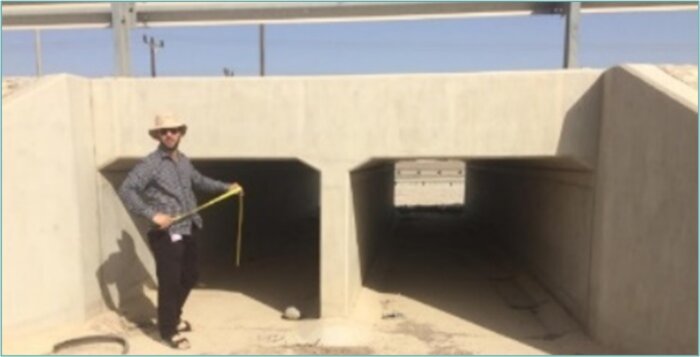
Box culvert measurements in Oman. All structures and their dimensions are incorporated and schematized in the 3Di model.
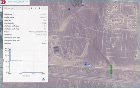
Screenshot of 3Di Live Site analysis function, green dot represents location of the water depth in graph.
- To know and understand flood risk at a certain location
- To guide a flood-proof urban expansion
- For flood risk communication
- For crisis management
- Input for operational flood early warning systems
The results of this study for the city of Muscat show clearly the hot spots that are prone to inundation during a flood event. Local inundation height, arrival times, velocity and duration of the inundation give hints concerning potential damages at those locations. With the high level of detail, the short computational time and the interactive access via the live site make 3Di modeling suitable for a broad target group of users. For GUtech in Oman this study helped to update their outdated flood maps and to provide new insights in their flood risk.
Read the scientific article here.
The study also got attention from the Times of Oman, read the article here.