Our solution 3Di is the preferred simulation software for engineers globally who work on flood resiliency, urban drainage design, catchment analyses and many other water management studies. The modeller interface makes the modelling process seamless, ensuring the models depict reality with high accuracy. Consequently, focus can be put on getting the message across to the stakeholders.
To support users in this process, we have made 3Di fully compatible with 3D environments.
With 3Di it is possible to offer your results in OGC 3D tiles format. Thanks to this open standard for 3D environments the results can be easily integrated in any Digital Twin environment. Whether it is a historic simulation run, or a new simulation, software integration with your Digital Twin of choice is possible through the API.
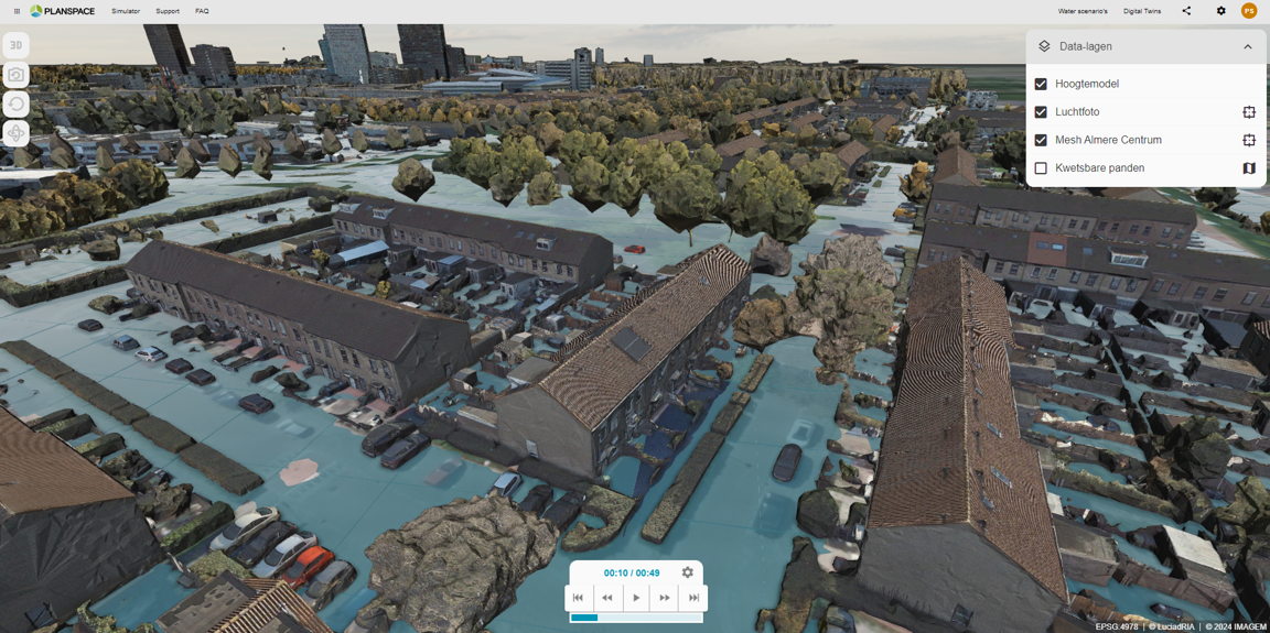
OGC 3D Tiles in a Digital Twin
After running your simulation, you can export the results as an OGC 3D Tiles set for seamless integration with your Digital Twin. If your Digital Twin supports this widely adopted open standard for 3D geospatial data, you can effortlessly visualize the simulation outcomes, such as flooding scenarios, in a detailed 3D environment.
This allows you to choose between displaying a single time step or a series of time steps, enabling the creation of dynamic animations that depict changes over time. This flexibility makes it easier to analyze and communicate the impact of various scenarios within your 3D model.
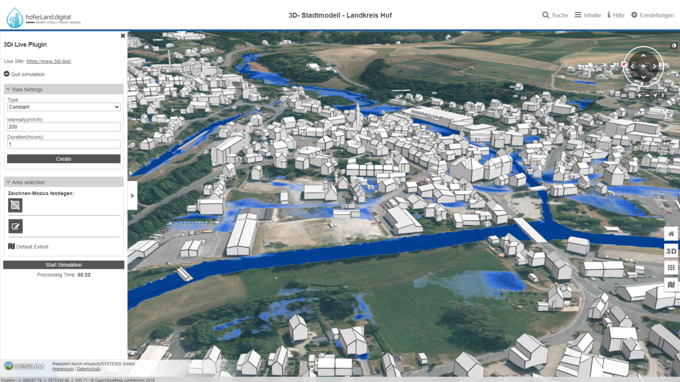
Run simulations in your Digital Twin
3Di enables you to run simulations directly within your Digital Twin environment, making it easier for users to perform their own calculations and instantly visualize the outcomes. This integration lowers the barrier for users, allowing them to quickly simulate scenarios, such as the impact of specific rainfall events, without needing to switch between different tools or platforms. By simplifying the process, 3Di empowers users to experiment, analyze, and make informed decisions with greater efficiency and confidence, all within the familiar interface of their Digital Twin.

Other Software integrations
Whether you are using a 3D Digital Twin or any other GIS software, integration with 3Di is fully achievable. This flexibility ensures that you can seamlessly incorporate 3Di’s powerful simulation capabilities into your preferred tools and workflows. For example, on the left, you can see a video demonstrating how 3Di integrates with Esri’s ArcGIS Pro and even Esri’s ArcGIS Online. This integration allows you to harness the strengths of these platforms, combining them with 3Di’s advanced modeling features to create a more robust and interactive geospatial analysis environment.