Climate resilience on Centrumeiland, Amsterdam
The Municipality of Amsterdam demonstrated foresight in addressing climate adaptation on Centrumeiland (central island), a key component of the IJburg district. Anticipating elevated water levels in the IJmeer and increased risk of both extreme rainfall and drought, the city implemented innovative measures to manage water effectively. 3Di was applied to shape the resilience of Centrumeiland.
Centrumeiland serves as a pivotal link between the established Haveneiland and the forthcoming Strandeiland, embodying a unique urban character within the IJburg development. The project aimed to integrate sustainable practices, including energy neutrality and climate adaptation, into the island’s design. This involved implementing a network of green infrastructure, including infiltrating green zones (wadi’s) and water-retaining roofs, to mitigate flood risks and improve ecological resilience.
In the planning phase, the Municipality of Amsterdam recognized the need for advanced hydrodynamic modelling to assess water dynamics and flood risks on Centrumeiland. Given 3Di’s capabilities, the city decided to collaborate with Nelen & Schuurmans to develop a model tailored to the island’s unique characteristics.
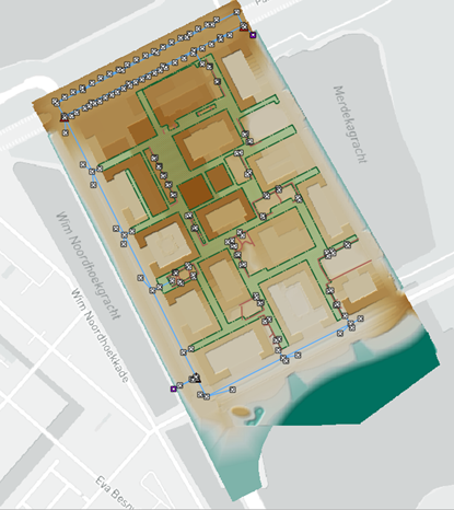
Model of Centrumeiland as represented in the 3Di Modeller Interface
3Di was deemed fruitful for a couple of reasons, but the main takeaways are the following. Firstly, an integral model incorporates all hydrological processes, from rainfall retention on buildings to runoff through streets and infiltration into green spaces. This comprehensive type of model simulation provides insights into water flow patterns and potential areas of concern during extreme weather events which traditional methods, such as rainfall-runoff relations incorporated in 0D/1D models, are not capable of.
Secondly, 3Di facilitated the assessment of flood risk under different rainfall scenarios, identifying areas susceptible to inundation and informing the design of infrastructure and urban space to mitigate these risks. This proactive approach ensured that the island’s development was resilient to future climate uncertainties.
Moreover, the model gave insights which improved the island’s drainage infrastructure design, such as better utilization of storage capacity in above as well as underground systems. By analyzing surface flow and flow through the drainage system together, it was possible to optimize storage capacity to reduce water ponding in locations where this was not desired.
Lastly, 3Di’s visualizations helped communicate complex hydrological concepts to a wider audience than de modeller and hydrologists, fostering engagement and support for sustainable water management practices from urban developers, architects and ecologists. This inclusive approach empowered the island’s resilience through initiatives like green roof installations and rainwater drainage, infiltration and transportation (DIT-)sewerage systems.
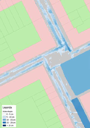
Water ponding on streets as simulated by 3Di
The application of 3Di in the development of Centrumeiland exemplifies its value in enhancing climate resilience and sustainable urban planning. By providing actionable insights into water dynamics and flood risks, 3Di empowers cities to build resilient communities and adapt to the impacts of climate change.
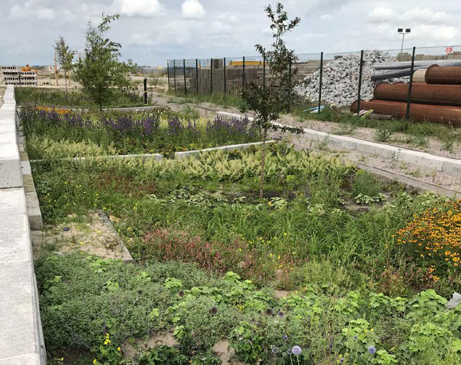
Realized infiltrating green zone designed to capture and retain rainwater